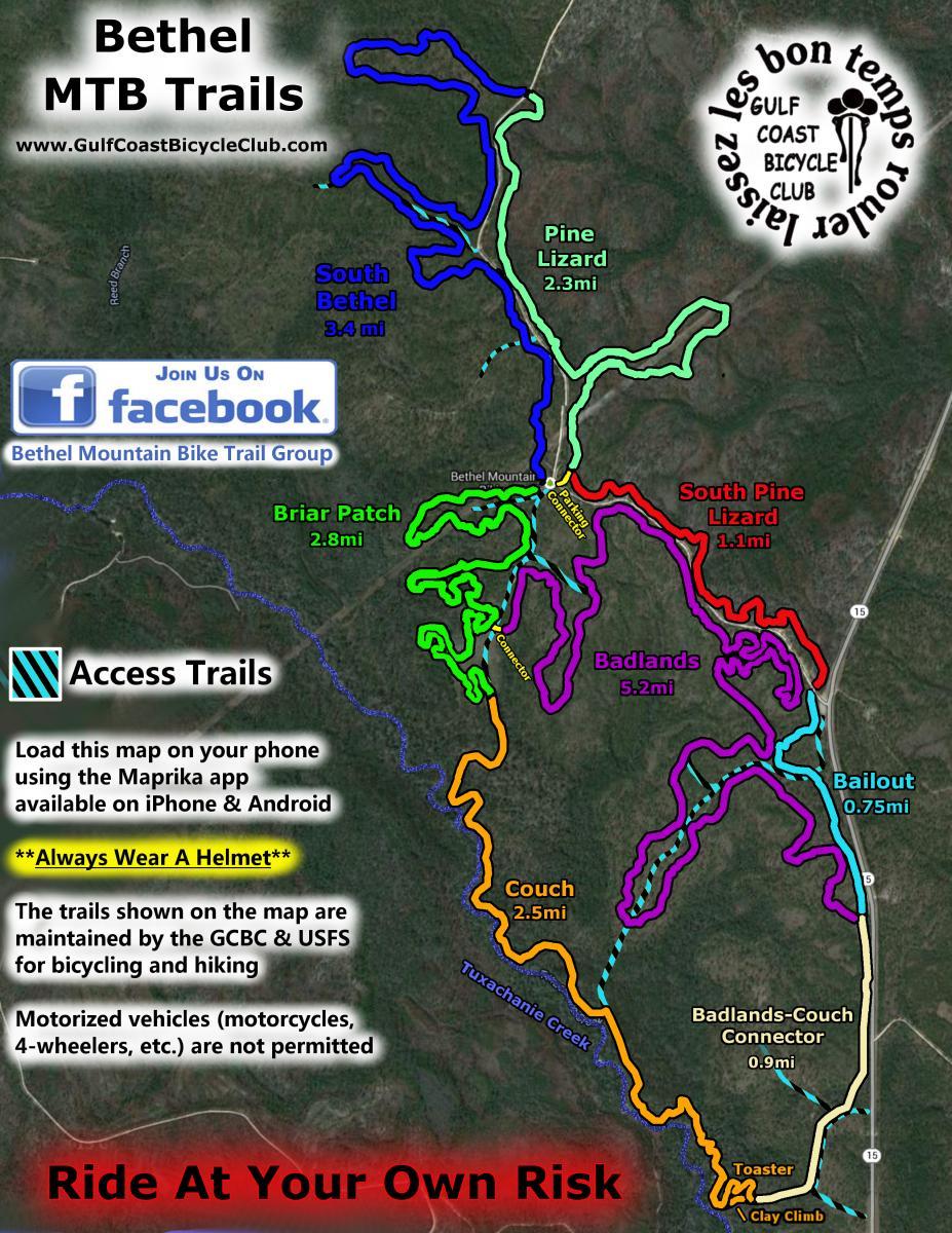
Bethel Trails - Saucier, MS (~70 mi from Mobile)
Bethel Mountain Bike Trails
DeSoto National Forest
DeSoto National Forest
Trailhead GPS Coordinates: 30.601448, -88.944746
Saucier, MS 39574
Saucier, MS 39574
Bethel Bike Trails are a network of trails (Pine Lizard, South Pine Lizard, Badlands, Couch Trail, Turtle Back Trail, Briar Patch, and South Bethel) which used to be Motorcycle trails. The trails are in the Desoto National Forest. They are primarily single track with the occasional fire and jeep trail. The trails are flat with only slight changes in elevation. The trails range from tight turns in the trees to scenic rides along the creeks. Be prepared for a variety of soils ranging from sand to hard packed dirt.
- 20 miles of mostly single track fun!
- Interlocking trail system
- Beginner to Intermediate riding
- Roots, sand, dirt, clay and water!
- Around 100' elevation
- Fast, fun and flowly trails
- All around GOOD FUN and great for new riders!

